GeoDesign — a web platform that helps businesses choose the right locations
2020 was a turning point for businesses around the world. In Ukraine, this was particularly felt by entrepreneurs working in the offline sector. Investments became even more cautious, and every decision was calculated several steps ahead. But every crisis also brings new opportunities. It was at this moment that GeoDesign was born — a Ukrainian startup that turned geospatial data into a powerful business tool.
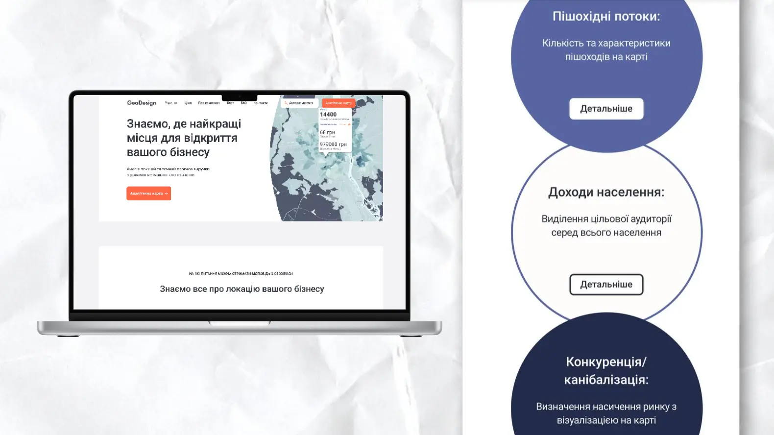
GeoDesign helps entrepreneurs choose the best location for opening or scaling a business. The service analyzes numerous parameters: population density, income level, pedestrian traffic, transport accessibility, competition, urban planning restrictions, and dozens of other factors. What's more, it takes into account how this data changes over time. Based on this huge array of data, entrepreneurs can predict the profitability of a store, pharmacy, café, or bank branch even before launch.
Challenge
The GeoDesign team processed a huge amount of information but faced a key challenge: how to make this large-scale, technically complex product accessible and easy to understand for regular users — and monetize it. In Ukraine, the habit of paying for information has not yet taken root. Many people rely on intuition or outdated approaches.
Objective
Therefore, through the platform, we also addressed the task of education — to explain that information = money, to show users why it’s smarter to use such a service during the planning stage — to gather critical input data before committing to rent or renovations and then moving out after some time due to low profitability.
The founders of the project approached us with these tasks. Our goal was not only to create a website, but to develop a full-fledged platform that:
- clearly presents the idea and advantages of the service;
- demonstrates its capabilities through real-world use cases;
- becomes a tool for direct work with geo-analytics.
Result:
The main feature of the platform is an interactive map that can tell you an infinite amount about any point in Ukrainian cities. It is the main interaction point: it allows you to select any point within large cities and instantly receive analytics on key parameters. Data is loaded and visualized in real time, filtered, layered, and illustrates the dynamics of change — all so that entrepreneurs can make informed decisions before investing in a location.
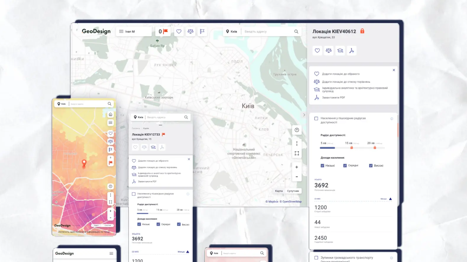
In addition to the map itself, we created a user-friendly interface, a personal account, with which the startup was finally able to monetize its titanic work, and a section with real cases of using the service in various niches. The service finally started speaking the user's language. Simple, clear, convincing.
Thanks to the GeoDesign platform, dozens of entrepreneurs were able to choose the right place to launch or scale their businesses. Their businesses are running successfully, growing, and proving the main idea of this project: data is the foundation of modern strategy.